Jeff could not sleep much in Dawson City, so he went for a walk at 3:20 AM with the dogs, once the thunder storm and heavy down poor had eased. Penny is super frightened over thunder so she was happy to get out there and walk. We were glad that we had rented two camp sites, so we could park the car on one and the trailer on the other beside it, then out the awnings out, so we had lots of space to hang out. It was also very convenient to get downtown for supplies like groceries and a quick coffee…
We left fairly early to hit the Dempster Highway. A road that’s well-known for a wide range of opinions from those who travel it. The Dempster Highway is approximately 736 kilometers (457 miles) long. It begins near Dawson City in Yukon, Canada, and extends to Inuvik in the Northwest Territories. The highway crosses the Arctic Circle and offers travelers a journey through remote and beautiful wilderness, including various challenges and weather conditions depending on the season. Additionally, an extension known as the Inuvik-Tuktoyaktuk Highway, completed in 2017, adds another 138 kilometers (86 miles), allowing year-round road access to Tuktoyaktuk on the Arctic Ocean.
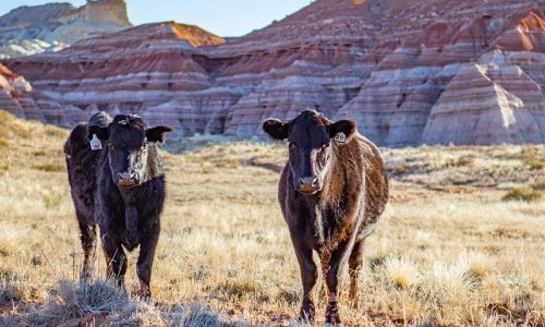
Just after mile post 59, we found Grizzly Lake Trail Hike in the Tombstone Territorial Park. Not that we hiked it… but we wrote it down in case we’ll ever be back, or if someone is doing research and maybe wants to check it out. A little bit further, at mile post 71, is the Tombstone Interpretive Centre, an info centre which is open from 9AM – 5PM from mid May till about the third week of September. It has several information plaques around the parking lot and one is explaining why all the vegetation is so short and small. This is due to the short growing season. A couple we talked to there said that the Caribou were migrating in August and September with many hunters after them, therefore the grizzlies are t to feast on the left overs… Yay! Bring it! I want to see! We had not seen any animals on the Dempster yet! But hopes were high!
A bit further, around mile post 121/122 we noticed a sign saying “Blackstone Outfitters” which offers guided hunting opportunities.
As we keep driving, we sure were admiring all the beautiful fall colours. There was a provincial campsite around Mile 193 called Engineer Creek, which is the standard Yukon style camping grounds. By 4PM the sky was blue with a few clouds and we have yet to see any wildlife!
By 4:30 we roll into Eagle Plains, around mile post 372. The Hotel is open and we knew to get gas here as it is the only gas station on the Dempster until Fort McPherson. The hotel is open till 10PM so we sat down had a nice glass of wine with their buffet dinner. It was $120 but that is to be expected when you are in remote locations. After this, we continue our journey and were on the lookout for a camping spot. We found a great one at mile post 395 to the left, but too exposed to the wind. Another great spot at mile 403-ish to the right, but we decided to keep going for now, to see if there was anything better.
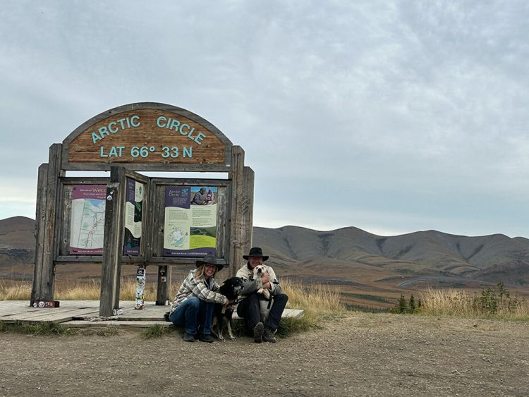
The Arctic Circle is at post 405, where we took a few photos with the sign. There were others so we kept going in hopes to beat them to a good spot to camp. No such luck. Before mile 408 everything was taken, although there was a great spot we liked to get on the way back, so we jotted it down. Many side roads there, and we needed up settling in by mile post 416 or so. Protected from the wind by a large mountain of shale rock, we settled in with a small camp fire.
The Arctic Circle is one of the five major circles of latitude that mark maps of the Earth. It is located at approximately 66.5 degrees north of the Equator. The word “Arctic” comes from a Greek word which means “near the bear”.
We sure can attest to this, but that is a story for another day in this journal! Stay tuned.